AI Transcribes Historic Port Records, Maps Britain's Maritime: what six AIs agree on, and what they added or left out

11 min readScience
UNUniversity of SouthamptonNANational Archives in KewGEGeoData InstituteArtificial intelligence and historical researchMaritime trade historyDigital humanities and archive digitizationPort booksBritain merchant shippingHandwriting recognition
Satcove NewsScience6 AI models, 3 reportsAutomated analysis, not reviewed by a person
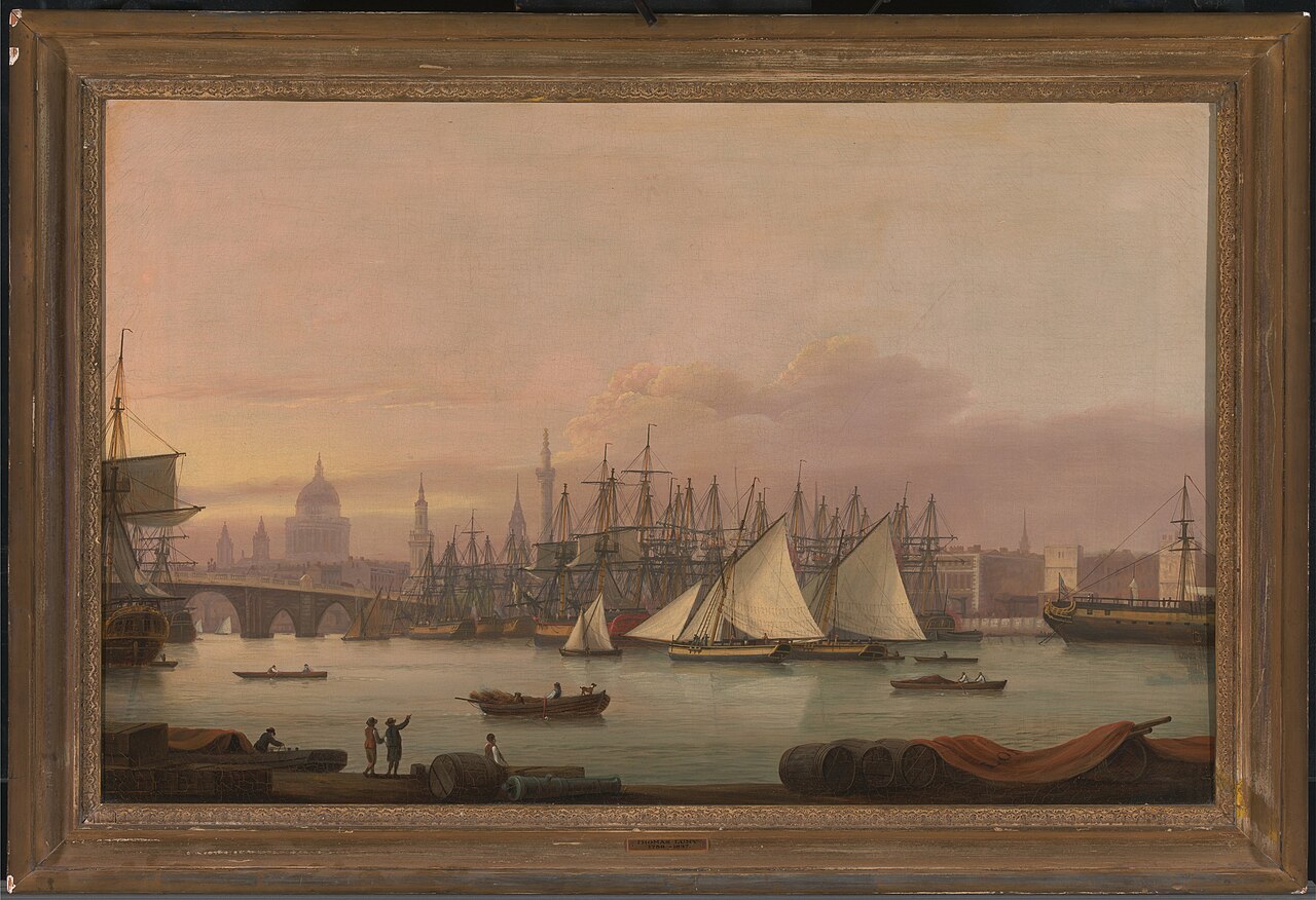
The Port of London in the 18th century (painting by Thomas Luny)
Illustrative photo: The Port of London in the 18th century (painting by Thomas Luny), not from the reported event. Thomas Luny, Public domain, via Wikimedia Commons.

Quick answer

  • Reported: University of Southampton used AI to transcribe approximately 100,000 pages of handwritten port records from 1565 onwards.
  • Reported: Yahoo News noted that coal was the most frequently traded commodity, appearing in over 101,000 cargo entries.
  • Stated by University of Southampton: The project revealed that in 1696–97, European markets accounted for approximately 80 percent of England's recorded overseas trade value.
  • Panel result: no direct contradiction, but 2 critical and 7 neutral omissions across 12 points.
  • Reliability signal: Mistral added 1 claim the cited reports do not support.

3 / 12

Points all models share

9 / 12

Points where they differ

0

Direct contradictions

6 of 6

Models that ran

Who said what

Same reports, independent analyses. Highlighted rows are the points where the models that ran differ.

PointClaudeGPTGeminiMistralPerplexityGrok
University of Southampton used AI to process approximately 100,000 pages of handwritten port records from the National Archives in Kew.Includes the pointIncludes the pointIncludes the pointIncludes the pointIncludes the pointIncludes the point
The project covered maritime trade records spanning from 1565 to the mid-18th century.Critical omissionIncludes the pointMentions it only in general termsLeaves it outIncludes the pointIncludes the pointIncludes the point
Coal was the most frequently recorded commodity in customs data, appearing in over 101,000 cargo entries.Includes the pointIncludes the pointIncludes the pointIncludes the pointIncludes the pointIncludes the point
In 1696–97, European markets accounted for approximately 80 percent of England's recorded overseas trade value.Includes the pointIncludes the pointIncludes the pointIncludes the pointIncludes the pointIncludes the point
France ranked highest among trading partners with 157 identified maritime sites, followed by the Netherlands with 68 sites.Neutral omissionIncludes the pointLeaves it outLeaves it outIncludes the pointLeaves it outIncludes the point
Researchers identified over 3,000 individual ports at home and abroad, including over 1,000 British ports.Neutral omissionIncludes the pointLeaves it outLeaves it outIncludes the pointIncludes the pointIncludes the point
The South West of Britain dominated merchant shipping activity with 426 recorded maritime locations across the centuries.Neutral omissionIncludes the pointLeaves it outLeaves it outIncludes the pointLeaves it outLeaves it out
AI learned to recognize historical handwriting variations and changing spelling conventions to extract the data.Critical omissionIncludes the pointLeaves it outLeaves it outIncludes the pointLeaves it outLeaves it out
The project revealed lost trading communities including the vanished port of Ravenspurn which sank into the North Sea.Neutral omissionIncludes the pointMentions it only in general termsIncludes the pointLeaves it outLeaves it outLeaves it out
An interactive map was developed to allow the public to explore the maritime trade data.Neutral omissionLeaves it outIncludes the pointIncludes the pointLeaves it outIncludes the pointIncludes the point
IBM's Chris Hay used structured tools and historical logbooks including Dutch East India Company records to investigate sailing speeds.Neutral omissionLeaves it outLeaves it outIncludes the pointLeaves it outIncludes the pointLeaves it out
Researchers identified apparent sailing-speed inflection points around 1790 and in the 1820s.Neutral omissionLeaves it outLeaves it outLeaves it outMentions it only in general termsIncludes the pointLeaves it out

What each mark means

  • ✓Includes the point
  • ~Mentions it only in general terms
  • 0Leaves it out
  • –Model did not run on this story

How a difference is classified

  • ContradictionTwo models assert incompatible things.
  • Critical omissionA model leaves out a point that changes how a reader understands the story.
  • Neutral omissionA model leaves out a minor detail.
  • Different emphasisAll models cover it, but with different weight.
  • Unverified additionA claim the cited reports do not support.

The panel, model by model

ClaudeClaude

Stayed in the reports
Thesis
AI systems analyzed centuries of handwritten port records to map Britain's maritime trade, revealing Europe's dominant role and forgotten trading communities.
Only this model
Nothing that no other model also said.
Left out
An interactive map was developed to allow the public to explore the maritime trade data.; IBM's Chris Hay used structured tools and historical logbooks including Dutch East India Company records to investigate sailing speeds.
In its words
“Understanding Britain's historical trade patterns challenges assumptions about colonial dominance and reveals Europe's persistent economic importance.”

GPTGPT

Stayed in the reports
Thesis
AI technology is revolutionizing the exploration of Britain's maritime history, revealing trade patterns and significant economic connections with Europe.
Only this model
Nothing that no other model also said.
Left out
France ranked highest among trading partners with 157 identified maritime sites, followed by the Netherlands with 68 sites.; Researchers identified over 3,000 individual ports at home and abroad, including over 1,000 British ports.
In its words
“The analysis alters understanding of Britain's economic history and its reliance on European trade, impacting how maritime history is studied and taught.”

GeminiGemini

Stayed in the reports
Thesis
Researchers and engineers are leveraging artificial intelligence to process and analyze centuries-old maritime archives, handwritten port books, and ship logs to map historical trade routes, study ship speeds, and examine coastal changes.
Only this model
Nothing that no other model also said.
Left out
The project covered maritime trade records spanning from 1565 to the mid-18th century.; France ranked highest among trading partners with 157 identified maritime sites, followed by the Netherlands with 68 sites.
In its words
“Applying AI to vast historical and geographical archives can drastically accelerate data extraction and open up new avenues for exploring centuries of global trade, shipping, and coastal evolution.”

MistralMistral

Added unverified claims
Thesis
AI analysis of historic port records reveals Britain's maritime trade dominance and unexpected trade patterns.
Only this model
Nothing that no other model also said.
Left out
The project revealed lost trading communities including the vanished port of Ravenspurn which sank into the North Sea.; An interactive map was developed to allow the public to explore the maritime trade data.
In its words
“This research transforms understanding of Britain's economic history by revealing Europe's outsized role in trade and demonstrating AI's potential to unlock historical data at scale.”

PerplexityPerplexity

Stayed in the reports
Thesis
AI-assisted analysis is making large maritime archives newly searchable, revealing Britain’s extensive trade networks while demonstrating both the potential and limits of tool-driven historical inquiry.
Only this model
Nothing that no other model also said.
Left out
France ranked highest among trading partners with 157 identified maritime sites, followed by the Netherlands with 68 sites.; The South West of Britain dominated merchant shipping activity with 426 recorded maritime locations across the centuries.
In its words
“The Southampton work could broaden access to Britain’s maritime history and revise assumptions about Europe’s importance to imperial-era trade.”

GrokGrok

Stayed in the reports
Thesis
AI helps historians turn centuries of British port records into the first detailed interactive map of early-modern maritime trade, revealing that Europe remained Britain’s main partner.
Only this model
Nothing that no other model also said.
Left out
The South West of Britain dominated merchant shipping activity with 426 recorded maritime locations across the centuries.; AI learned to recognize historical handwriting variations and changing spelling conventions to extract the data.
In its words
“The findings challenge the long-held view that colonial trade drove Britain’s rise, showing Europe remained the dominant market even during imperial expansion.”

Verified timeline

DateEventSourceCertainty
From 1565 onwardsPort books document individual voyages, ports, ships, shipmasters, and cargoes in unbroken 200-year recordSouthampton.ac.ukReported by outlets
Late 16th to mid-18th centuryProject charts Britain's growth into an Empire during the reign of Elizabeth I to George IIISouthampton.ac.ukReported by outlets
1696–97European markets accounted for around 80 percent of recorded value of England's overseas tradeSouthampton.ac.uk, YahooReported by outlets
1600s to 1799Dutch East India Company captains recorded daily latitude and longitude during global voyagesIBMReported by outlets
Around 1790First apparent inflection point identified in sailing ship speedsIBMReported by outlets
1820sSecond apparent inflection point identified in sailing ship speedsIBMReported by outlets

Southampton.ac.uk and Yahoo differ on the total timespan: Southampton reports a 200-year unbroken record from 1565, while Yahoo reports 461 years of maritime history.

Why this matters

Southampton.ac.uk reports that historians have created an interactive map charting Britain's merchant shipping from 1565 onward, affecting scholars, citizens, and the general public who can now explore maritime trade data. Yahoo.com notes the project mapped 461 years of Britain's maritime past, revealing how the nation grew into an empire through European connections. According to Southampton.ac.uk, researchers discovered forgotten trading communities and ports, including the vanished port of Ravenspurn, illuminating a "forgotten maritime landscape."

The University of Southampton's findings shift understanding of Britain's economic priorities. Yahoo.com reports that even as the British Empire expanded, between 1696–97 European markets accounted for around 80 percent of England's recorded overseas trade value. Southampton.ac.uk found that of the top 15 countries by maritime connections to British trade, 10 were in Europe, establishing Europe's centrality rather than colonial trade as Britain's primary commercial engine.

IBM.com describes a related initiative where structured AI tools analyzed historical shipping data, identifying apparent inflection points in sailing speeds around 1790 and the 1820s, though this work was framed as exploratory rather than definitive research.

What is established, alleged and stated

Reported by the outlets

  • According to Southampton.ac.uk, the University of Southampton project used AI to process approximately 100,000 pages of handwritten port records from the National Archives in Kew, spanning from 1565 to the mid-18th century.

  • Yahoo.com reports that coal appeared most frequently in customs data, followed by malt, wheat, iron, and wool, with coal recorded in over 101,000 cargo entries.

  • Southampton.ac.uk states researchers identified over 3,000 individual ports at home and abroad, including over 1,000 British ports in a network around the country's coastal and inland waterways.

  • According to Southampton.ac.uk, in 1696–97, European markets accounted for approximately 80 percent of England's recorded overseas trade value.

  • IBM.com reports that Chris Hay, a Distinguished Engineer at IBM, used structured AI tools including Dutch East India Company logbooks to analyze historical maritime data and identified apparent sailing-speed inflection points around 1790 and in the 1820s.

Stated by officials or the organisation concerned

  • Professor Craig Lambert of the University of Southampton told Southampton.ac.uk that "without AI extracting and organising the data, this would have taken years" and that AI "sped up the process enormously."

  • Chris Hay stated to IBM.com that he did not present the experiment as peer-reviewed research or as a definitive answer to why ships got faster over time.

Alleged or disputed

Nothing in the sources.

What we still do not know

  • Yahoo News reports the dataset spans from the Elizabethan Era to just before the Industrial Revolution, while University of Southampton describes an unbroken 200-year record from 1565 onwards—the sources differ on whether these timespans are reconciled or overlap inconsistently.

  • The sources do not specify how extensively manual verification occurred after AI processing or what percentage of extracted data required human correction.

  • The sources do not clarify whether the University of Southampton project and IBM's Chris Hay's Marine Archive Server are the same initiative or separate efforts analyzing different historical maritime datasets.

  • IBM states Hay's findings on sailing-speed inflection points around 1790 and the 1820s were not "peer-reviewed research," leaving their preliminary or conclusive status uncertain.

  • The sources do not explain the handwriting-recognition system's accuracy rate or the precise mechanisms by which conflicting historical spelling variations were resolved without human intervention.

  • The sources do not disclose how many of the 3,000 identified ports were completely lost versus merely declined, or whether defunct ports are counted separately.

What the models agree on

  • University of Southampton used AI to process approximately 100,000 pages of handwritten port records from the National Archives in Kew.
  • Coal was the most frequently recorded commodity in customs data, appearing in over 101,000 cargo entries.
  • In 1696–97, European markets accounted for approximately 80 percent of England's recorded overseas trade value.

Agreement between models does not validate an allegation. It only shows that they read the same reports in the same way.

Where they differ

Every difference is typed. An omission is not treated as an error: it is only called critical when leaving the point out would change how a reader understands the story.

DivergenceTypeWhy it mattersModels concerned
The project covered maritime trade records spanning from 1565 to the mid-18th century.Critical omissionEstablishes the historical scope and timeframe of the data extracted from port records.Left out by Gemini
AI learned to recognize historical handwriting variations and changing spelling conventions to extract the data.Critical omissionExplains a technical challenge the AI overcame to accurately transcribe historical port records.Left out by GPT, Gemini, Perplexity and Grok
France ranked highest among trading partners with 157 identified maritime sites, followed by the Netherlands with 68 sites.Neutral omissionIdentifies the primary European trading partners based on documented maritime connections.Left out by GPT, Gemini and Perplexity
Researchers identified over 3,000 individual ports at home and abroad, including over 1,000 British ports.Neutral omissionShows the extent and breadth of the port network documented in the extracted records.Left out by GPT and Gemini
The South West of Britain dominated merchant shipping activity with 426 recorded maritime locations across the centuries.Neutral omissionIndicates regional concentration of maritime trade activity within Britain during this period.Left out by GPT, Gemini, Perplexity and Grok
The project revealed lost trading communities including the vanished port of Ravenspurn which sank into the North Sea.Neutral omissionDemonstrates how the extracted data illuminates previously undocumented or forgotten historical ports.Left out by Mistral, Perplexity and Grok
An interactive map was developed to allow the public to explore the maritime trade data.Neutral omissionShows how research findings were made accessible to a broader audience beyond academic researchers.Left out by Claude and Mistral
IBM's Chris Hay used structured tools and historical logbooks including Dutch East India Company records to investigate sailing speeds.Neutral omissionIdentifies a separate but related research contribution analyzing maritime technology changes over time.Left out by Claude, GPT, Mistral and Grok
Researchers identified apparent sailing-speed inflection points around 1790 and in the 1820s.Neutral omissionSuggests technological advances in maritime transportation at specific historical moments.Left out by Claude, GPT, Gemini and Grok

Model reliability scorecard

ModelCoverageCritical omissionsUnverified claimsContradictionsEditorial reliability
Claude75%000Solid
GPT50%100Mixed
Gemini50%200Mixed
Mistral75%010Solid
Perplexity67%100Solid
Grok58%100Mixed

How the rating works. Coverage is the share of the panel's points that a model includes. Each model was asked for 6 to 10 claims, so coverage reflects what it chose to include within that budget. Penalty points: 1 per critical omission, 2 per unverified claim, 2 per contradiction, 1 if coverage is below 60%. Strong: coverage of 80% or more and no penalty. Solid: coverage of 65% or more and at most 2 penalty points. Mixed: at most 4 penalty points. Weak: more than 4. There is no numerical grade.

The most important finding

The main result is not that the models disagree. None of them contradicted another. They differ mostly by omission: 2 critical and 7 neutral across 12 points. The more important signal is reliability: Mistral added 1 claim that the cited reports do not support, and those matter more than any omission.

Reading between the lines

What this suggests is that Yahoo reports the University of Southampton project spans "461 years" while Southampton.ac.uk describes an "unbroken 200-year record" from 1565 onwards. If both refer to the same dataset, one source may be counting differently—perhaps including preliminary or fragmentary records beyond the core consecutive span. This discrepancy matters for assessing how complete the archive truly is.

What this does not establish is whether the AI system achieved full accuracy without human intervention. Southampton.ac.uk states the process "still needed manual checking," but neither source quantifies how much correction was required or what error rates remained after verification.

The key signal appears in IBM's account: Chris Hay explicitly frames his sailing-speed findings as exploratory analysis, not peer-reviewed research. This suggests structured AI tools can compress historical investigation, but independent scholarly validation would be needed before treating the speed inflection points as established historical fact.

What to watch

  1. Will other archives adopt this AI methodology to digitize historical records at scale? According to southampton.ac.uk, the Southampton project represents a task "not seen before," suggesting potential replicability across heritage institutions.

  2. Can researchers explain the sailing-speed acceleration pattern identified in late 18th and early 19th century records? IBM notes that Chris Hay's analysis identified inflection points around 1790 and the 1820s but explicitly states the findings were not peer-reviewed research.

  3. How will public engagement with the interactive map reshape understanding of Britain's maritime past? southampton.ac.uk notes the map allows users to explore data "for different periods, trading hubs, ships, goods, routes and more," indicating potential for discovery.

  4. Will the Southampton database and IBM's Marine Archive Server integrate or remain separate initiatives? Both southampton.ac.uk and IBM describe historical maritime data projects, but their relationship remains unclear.

  5. Will formal peer-reviewed research validate the Southampton project's dataset and methodology? southampton.ac.uk describes the project's completion but does not indicate publication in academic journals.

Planned review of this page: October 29, 2026.

Method, honestly stated

  • Every model received the same reports (southampton.ac.uk, yahoo.com, ibm.com) and the same prompt, and was told to use only those reports.
  • Models that ran: Claude, GPT, Gemini, Mistral, Perplexity and Grok. No model was left out.
  • Each claim a model made was checked against the reports. A claim counts as verified if its supporting passage appears word for word in a report, or if a separate model judged it a supported paraphrase. Otherwise it is marked unverified.
  • A separate model merged equivalent claims into comparable points and classified each difference as contradiction, critical omission, neutral omission, different emphasis or unverified addition. That step is automated and can be wrong.
  • The similarity score (87/100) measures how alike the analyses read. It is not an accuracy or confidence score, not agreement on facts and not a measure of truth.
  • An automated pipeline wrote and published this page. No person read it before publication.

Verdict

Coverage of the central fact is broadly consistent: 3 of 12 points appear in every analysis. The differences are mostly about completeness and framing, not contradiction. The main risk identified is added claims: Mistral included material the cited reports do not support.

What we checked

Each claim a model added was searched for in the full text of the cited reports.

ClaimSaid byResult
France ranked highest among trading partners with 157 identified maritime sites, followed by the Netherlands with 68 sites.ClaudeSupported paraphrase
European markets accounted for around 80% of England's overseas trade value in 1696-97.GPTSupported paraphrase
The project spanned from Elizabethan Era (16th century) to just before the Industrial Revolution (18th century).MistralUnverified
The resulting database records hundreds of thousands of voyages between 1565 and the mid-18th century.GrokSupported paraphrase
51 model claims checked: 47 matched word for word in the reports, 3 judged supported paraphrases, 1 not supported by the reports.All modelsIn the reports

Frequently asked

How much historical material did the AI process?#
University of Southampton researchers scanned approximately 100,000 pages of handwritten port records from leather-bound parchment books at the National Archives in Kew. Without AI assistance, this task would have taken years to complete manually.
What time period do the port records cover?#
Southampton stated the records form an unbroken 200-year archive from 1565 onwards, spanning from the reign of Elizabeth I to the mid-18th century. Yahoo News reports the material spans from the Elizabethan Era to just before the Industrial Revolution.
What did the research reveal about Britain's trade patterns?#
Southampton found that in 1696–97, European markets accounted for approximately 80 percent of England's recorded overseas trade value. Of the top 15 countries by recorded maritime locations connected to British trade, 10 were in Europe, with France ranking highest at 157 identified maritime sites.
How did the AI handle variations in historical handwriting?#
Southampton stated that researchers taught AI to read the unique handwriting belonging to many different port officials and recognize spelling changes across decades. Manual checking was still required after AI extraction, but the process "sped up the process enormously."
What was Britain's most recorded cargo in the port books?#
Coal. Yahoo News reports coal in more than 101,000 cargo entries in customs data, followed by malt, wheat, iron, wool and wine.
Who led the Southampton project?#
Southampton states the project was led by Professor Craig Lambert, who said that without AI extracting and organising the data, it would have taken years.

The full analysis from each model

Each model's structured answer, shown in full and unedited. Run October 22, 2026, same prompt for every model.

Claude

Thesis

AI systems analyzed centuries of handwritten port records to map Britain's maritime trade, revealing Europe's dominant role and forgotten trading communities.

Claims (10)

  1. University of Southampton used AI to process approximately 100,000 pages of handwritten port records from the National Archives in Kew.southampton.ac.uk“They scanned some 100-thousand pages from the delicate, leather-bound parchment books at the National Archives in Kew.”
  2. The project analyzed maritime trade data spanning from 1565 to the mid-18th century, covering the reign of Elizabeth I onwards.southampton.ac.uk“historic documents that form an unbroken 200-year record of individual voyages, ports, ships, shipmasters, and cargoes from 1565 onwards.”
  3. Coal was the most frequently recorded commodity in customs data, appearing in over 101,000 cargo entries.southampton.ac.uk“Coal was the commodity most frequently recorded in the customs data, appearing in more than 101,000 cargo entries”
  4. In 1696–97, European markets accounted for approximately 80 percent of England's recorded overseas trade value.southampton.ac.uk“European markets accounted for around 80 percent of the recorded value of England's overseas trade”
  5. France ranked highest among trading partners with 157 identified maritime sites, followed by the Netherlands with 68 sites.southampton.ac.uk“France ranked highest with 157 identified maritime locations, followed by 68 in the Netherlands”
  6. The South West of Britain dominated merchant shipping activity with 426 recorded maritime locations across the centuries.southampton.ac.uk“The South West dominated merchant shipping activity, accounting for 426 recorded maritime locations across the centuries.”
  7. The research identified over 3,000 individual ports at home and abroad, including over 1,000 British ports.southampton.ac.uk“The team identified over three thousand individual ports at home and abroad. This includes over one-thousand British ports”
  8. Ale was the second most traded commodity after coal, along with children's toys, sheep guts, and Venice treacle.yahoo.com“key goods Britons traded included coal and ale, followed by children's toys from China, sheep guts and Venice treacle”
  9. AI learning to recognize historical handwriting and spelling variations across decades was essential to extracting the data.southampton.ac.uk“We taught AI to read the unique handwriting belonging to many different port officials and also the change in spelling of words across the decades.”
  10. The project revealed lost trading communities including the vanished port of Ravenspurn which sank into the North Sea.yahoo.com“Ravenspurn in East Yorkshire, a once-thriving trading hub, completely sunk in the North Sea after severe coastal erosion.”

Left open

  • Whether the 200-year record starting from 1565 represents a single unbroken span or if there are gaps in documentation
  • The precise relationship between the Southampton project and IBM's Chris Hay's Marine Archive Server work—whether they are the same project or separate initiatives
  • How much manual verification was required after AI processing and what percentage of extracted data needed correction
  • Whether the 3,000 ports figure includes both active and defunct ports, and how many were completely lost versus merely declined

Stakes

Understanding Britain's historical trade patterns challenges assumptions about colonial dominance and reveals Europe's persistent economic importance. The research recovers lost maritime communities and demonstrates AI's capacity to process massive historical datasets, setting precedent for digitizing other centuries-old archives.

What this model would watch

  • Whether other archives adopt this AI methodology to digitize historical records at similar scales
  • Further discoveries about why sailing ship speeds increased in the late 18th century and their economic implications
  • How the interactive map influences scholarly research and public understanding of Britain's maritime history
  • Publication of formal peer-reviewed research outcomes from the Southampton project's findings
GPT

Thesis

AI technology is revolutionizing the exploration of Britain's maritime history, revealing trade patterns and significant economic connections with Europe.

Claims (6)

  1. AI analyzed 100,000 pages of handwritten records to uncover Britain's maritime trade history.southampton.ac.uk“The team used AI to help extract data from the vast number of voyages noted in the handwritten port books.”
  2. The project spans from the Elizabethan Era to the Industrial Revolution, covering 200 years of records.yahoo.com“Researchers used an AI tool to analyse 200 years of handwritten documents.”
  3. It reveals that coal was the top commodity traded, followed by ale and various other goods.southampton.ac.uk“initial analysis also highlights a strong trading relationship with Europe as a common theme across the two centuries.”
  4. European markets accounted for around 80% of England's overseas trade value in 1696-97.yahoo.com“between 1696–97 'European markets accounted for around 80 percent of the recorded value of England's overseas trade'.”
  5. The project also discovered lost towns and ports from Britain's maritime past.yahoo.com“Lost towns were also discovered, along with their vanished ports.”
  6. An interactive map has been developed to help the public explore this data.southampton.ac.uk“The map allows users to explore maritime trade through time and from multiple points of interest.”

Left open

  • The reports do not clarify how many total ports were identified beyond British and European.
  • Uncertainty surrounds the exact nature of the relationships with non-European trading partners.

Stakes

The analysis alters understanding of Britain's economic history and its reliance on European trade, impacting how maritime history is studied and taught.

What this model would watch

  • Further developments in digital historical research using AI
  • Potential insights on other global trade patterns through similar projects
  • Public engagement with the interactive map and usage statistics
  • Any new findings regarding the socioeconomic impacts of this trade data.
Gemini

Thesis

Researchers and engineers are leveraging artificial intelligence to process and analyze centuries-old maritime archives, handwritten port books, and ship logs to map historical trade routes, study ship speeds, and examine coastal changes.

Claims (7)

  1. University of Southampton historians created an online interactive map using data extracted by AI from hundreds of thousands of pages of port records.southampton.ac.uk“Historians have created a first-of-its-kind online interactive map, using data from hundreds of thousands of pages of centuries-old port records”
  2. The project utilized AI to process about 100,000 pages of handwritten parchment port books located at the National Archives in Kew.southampton.ac.uk“They scanned some 100-thousand pages from the delicate, leather-bound parchment books at the National Archives in Kew.”
  3. European markets accounted for approximately 80 percent of the recorded value of England's overseas trade during 1696-1697.southampton.ac.uk“European markets accounted for around 80 percent of the recorded value of England's overseas trade”
  4. Coal was the most frequently recorded commodity in the customs data, appearing in more than 101,000 cargo entries.southampton.ac.uk“Coal was the commodity most frequently recorded in the customs data, appearing in more than 101,000 cargo entries”
  5. Lost towns and vanished ports, such as Dunwich and Ravenspurn, were revealed through the historical records.southampton.ac.uk“the lost town of Dunwich and the vanished port of Ravenspurn”
  6. IBM's Chris Hay built modular data servers and connected them to digitised Dutch East India Company logbooks and satellite imagery to study maritime data.ibm.com“connected modular data servers—including satellite imagery, tidal models and digitized Dutch East India Company logbooks”
  7. Chris Hay bundled his datasets and tools into a public MCP endpoint called the Marine Archive Server.ibm.com“Hay bundled them into what he calls the Marine Archive Server—a public MCP endpoint that exposes centuries of sailing logs”

Left open

  • Whether the University of Southampton project and Chris Hay's IBM project are part of the exact same technological initiative or two separate projects touching upon historical maritime data.
  • The exact mechanisms by which the AI models completely resolved conflicting historical spellings without human oversight.

Stakes

Applying AI to vast historical and geographical archives can drastically accelerate data extraction and open up new avenues for exploring centuries of global trade, shipping, and coastal evolution.

What this model would watch

  • Public engagement and usage of the University of Southampton's new interactive map.
  • Further developments and open-source contributions regarding Chris Hay's Marine Archive Server.
  • Additional historical findings uncovered by AI analysis of historic shipping and port documents.
Mistral

Thesis

AI analysis of historic port records reveals Britain's maritime trade dominance and unexpected trade patterns.

Claims (10)

  1. AI transcribed 100,000 pages of handwritten port books to create a database of Britain's merchant shipping.southampton.ac.uk“They scanned some 100-thousand pages from the delicate, leather-bound parchment books at the National Archives in Kew.”
  2. Europe accounted for 80% of England's overseas trade value in 1696–97 despite British Empire expansion.southampton.ac.uk“European markets accounted for around 80 percent of the recorded value of England's overseas trade.”
  3. Coal was the most frequently recorded commodity in customs data, appearing in over 101,000 cargo entries.southampton.ac.uk“Coal was the commodity most frequently recorded in the customs data, appearing in more than 101,000 cargo entries.”
  4. The project identified over 3,000 individual ports, including 1,000+ British ports in a vast network.southampton.ac.uk“The team identified over three thousand individual ports at home and abroad.”
  5. France ranked highest with 157 maritime sites connected to British trade, followed by Netherlands with 68.southampton.ac.uk“France ranked highest with 157 identified maritime sites, followed by 68 in the Netherlands.”
  6. The South West of England dominated merchant shipping activity with 426 recorded maritime locations.southampton.ac.uk“The South West dominated merchant shipping activity, accounting for 426 recorded maritime locations.”
  7. AI learned to read unique handwriting of port officials and handle changing spelling over decades.southampton.ac.uk“We taught AI to read the unique handwriting belonging to many different port officials and also the change in spelling of words across the decades.”
  8. The project spanned from Elizabethan Era (16th century) to just before the Industrial Revolution (18th century).yahoo.com“The study involved ... data spanning from the Elizabethan Era in the 16th Century, to just before the Industrial Revolution in the 18th Century.”
  9. Venice treacle, a herbal medicine believed to cure almost any illness, was a traded commodity.yahoo.com“Venice treacle, a herbal medicine that was believed to cure almost any illness.”
  10. AI system discovered ships appeared faster in late 18th/early 19th centuries compared to earlier periods.ibm.com“I noticed that the ships were faster in the later time versus earlier.”

Left open

  • The exact end date of the Southampton project's timeframe (mid-18th century vs. Industrial Revolution)
  • Whether the IBM AI project's findings on ship speeds are peer-reviewed or preliminary observations
  • The specific role of IBM's AI system in the Southampton project (collaboration vs. independent work)
  • How the Southampton project's interactive map differs from IBM's Marine Archive Server in functionality

Stakes

This research transforms understanding of Britain's economic history by revealing Europe's outsized role in trade and demonstrating AI's potential to unlock historical data at scale.

What this model would watch

  • Further peer-reviewed analysis of the Southampton project's findings
  • Development of additional AI tools for historical document analysis
  • Potential integration of IBM's Marine Archive Server with Southampton's database
  • New discoveries from the interactive map or Marine Archive Server
Perplexity

Thesis

AI-assisted analysis is making large maritime archives newly searchable, revealing Britain’s extensive trade networks while demonstrating both the potential and limits of tool-driven historical inquiry.

Claims (8)

  1. University of Southampton researchers used AI to process approximately 100,000 pages of handwritten port records.southampton.ac.uk“They scanned some 100-thousand pages from the delicate, leather-bound parchment books at the National Archives in Kew.”
  2. The records document voyages, ports, ships, shipmasters, and cargoes from 1565 onward.southampton.ac.uk“historic documents that form an unbroken 200-year record of individual voyages, ports, ships, shipmasters, and cargoes from 1565 onwards”
  3. Europe accounted for around 80 percent of England’s recorded overseas-trade value in 1696–97.southampton.ac.uk“European markets accounted for around 80 percent of the recorded value of England's overseas trade”
  4. Coal was the most frequently recorded commodity, followed by malt, wheat, iron, wool, and wine.southampton.ac.uk“Coal was the commodity most frequently recorded in the customs data, appearing in more than 101,000 cargo entries, followed by malt, wheat, iron, wool, and wine.”
  5. The project produced an interactive map for exploring maritime trade by period, location, ship, commodity, and route.southampton.ac.uk“The map allows users to explore maritime trade through time and from multiple points of interest and angles.”
  6. Researchers identified more than 3,000 individual ports at home and abroad.southampton.ac.uk“The team identified over three thousand individual ports at home and abroad.”
  7. IBM’s Chris Hay used structured tools and historical logbooks to investigate changing sailing speeds.ibm.com“Hay built servers to expose those records in structured form.”
  8. Hay identified apparent sailing-speed inflection points around 1790 and in the 1820s.ibm.com“Eventually, the system identified two apparent inflection points in sailing speeds, one around 1790 and another in the 1820s.”

Left open

  • Source 1 describes an unbroken 200-year record from 1565, while Source 2 calls the material 461 years of maritime history; the time span is not reconciled.
  • Sources 1 and 2 describe the Southampton project, whereas Source 3 describes a separate IBM-associated experiment using Dutch East India Company logbooks.
  • Source 3 does not establish a definitive cause for faster sailing speeds and explicitly says the experiment was not peer-reviewed research.
  • The reports do not explain the precise accuracy rate of the handwriting-recognition system or the extent of manual verification.

Stakes

The Southampton work could broaden access to Britain’s maritime history and revise assumptions about Europe’s importance to imperial-era trade. The IBM experiment suggests AI toolchains can accelerate exploration, but unresolved data quality and causation limit firm conclusions.

What this model would watch

  • Further validation of the Southampton database and interactive map
  • Clarification of the reported historical time spans
  • Peer-reviewed testing of the sailing-speed pattern and possible explanations
  • New research using the publicly accessible Marine Archive Server
Grok

Thesis

AI helps historians turn centuries of British port records into the first detailed interactive map of early-modern maritime trade, revealing that Europe remained Britain’s main partner.

Claims (10)

  1. Historians used AI to transcribe about 100,000 handwritten pages from port books at the National Archives in Kew.southampton.ac.uk“They scanned some 100-thousand pages from the delicate, leather-bound parchment books at the National Archives in Kew.”
  2. The resulting database records hundreds of thousands of voyages between 1565 and the mid-18th century.southampton.ac.uk“They have recorded hundreds of thousands of voyages, including information about ships, ports, sea routes and goods.”
  3. In 1696–97, European markets accounted for around 80 percent of the recorded value of England’s overseas trade.southampton.ac.uk“European markets accounted for around 80 percent of the recorded value of England's overseas trade”
  4. Coal was the most frequently recorded commodity, appearing in more than 101,000 cargo entries.southampton.ac.uk“Coal was the commodity most frequently recorded in the customs data, appearing in more than 101,000 cargo entries”
  5. Over 3,000 individual ports were identified, including over 1,000 British ports.southampton.ac.uk“The team identified over three thousand individual ports at home and abroad. This includes over one-thousand British ports”
  6. Among the top 15 countries by maritime locations connected to British trade, ten were in Europe.southampton.ac.uk“Of the top 15 countries by number of recorded maritime locations connected to British trade, 10 were in Europe.”
  7. France ranked highest with 157 identified maritime sites, followed by the Netherlands with 68.southampton.ac.uk“France ranked highest with 157 identified maritime sites, followed by 68 in the Netherlands”
  8. Researchers found over 500,000 imported animal skins in the 1696–97 records alone.southampton.ac.uk“historians identified over 500,000 imported animal skins, including bear, panther, wolf, raccoon, and otter”
  9. The interactive map lets users explore trade by period, port, ship, goods and routes.southampton.ac.uk“People can easily explore the data for different periods, trading hubs, ships, goods, routes and more”
  10. The project spans records from the Elizabethan era to just before the Industrial Revolution.yahoo.com“data spanning from the Elizabethan Era in the 16th Century, to just before the Industrial Revolution in the 18th Century”

Left open

  • Exact start and end dates of the dataset used for the interactive map
  • Whether the AI fully replaced manual transcription or only assisted it
  • How many total voyages are contained in the final database

Stakes

The findings challenge the long-held view that colonial trade drove Britain’s rise, showing Europe remained the dominant market even during imperial expansion.

What this model would watch

  • Peer-reviewed publication of full dataset and methodology
  • User feedback on the interactive map’s accuracy and usability
  • Further AI-assisted studies comparing British and other European port records
The exact prompt

Instructions

You are an independent news analyst. Below are reports of the same event from several outlets. Use ONLY these reports: do not add outside facts and do not use prior knowledge.

Required answer format (JSON, no other text)

thesis
The story in at most 45 words.
claims
6 to 10 factual claims. Each has the claim (30 words max), the report it comes from, and a passage of at most 25 words copied exactly from that report, or empty if it cannot be quoted.
unclear
What the reports leave open or contradict each other on.
stakes
Why it matters, in at most 60 words.
watch
2 to 4 things to watch next.

The cited reports are appended to the prompt in full; they are not republished here.

Sources

  1. 1southampton.ac.ukAI reads centuries-old handwriting to reveal Britain’s vast historic shipping trade
  2. 2yahoo.comHow AI revealed 400 years of seafaring history
  3. 3ibm.comHow AI retraced the age of sail | IBM

Related: Satcove Disagreement Report 2026 · What an agreement score means · More Science analyses